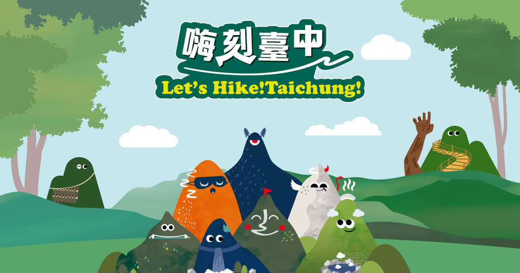
Let’s Hike! Taichung!
- Activity Time
- 2025-06-15~2025-12-15

🔶For the latest trail access updates, please visit the “Taiwan Forest Recreation website”: https://recreation.forest.gov.tw/
🔶Starting in 2025, the former “Guguan Seven Heroes Zone” will be rebranded as the “Hiking Promotion Zone”. In addition to the popular Guguan Seven Heroes challenge, two new certified hiking trail will be introduced (expected to launch by the end of July). We warmly invite hikers of all ages to explore these trails, reconnect with nature, and experience the joy of hiking!
🔶Thanks to the incredible enthusiasm of our hiking community, all “Five-Round Badges” for the “Guguan Seven Heroes Certification” challenge have now been fully redeemed! For applicants who have not yet received their badge: if your application meets the eligibility criteria and falls within the distribution limit, we will continue processing in order. Thank you for your patience and understanding.
🔶The second phase of the Xueshankeng Loop Trail is scheduled to be completed and opened to the public by the end of 2025. The first phase of the trail remains passable for hiking.🚧 Please do not enter any construction fence areas for your safety!
Event Announcement:
- Certification Methods: Participants may complete the certification through either the “Fun in Taichung app” (digital certification) or submitting a "Paper Achievement Record"
- Download the “Fun in Taichung app” iPhone Version – Download Link and Android Version – Download Link
- Download "Paper Achievement Record": Guguan Seven Heroes Record Sheet and Hiking Trail Mission Record Sheet (Mailing Address: 2F., No. 302, Wenxin South 3rd Road, Nantun District, Taichung City 408 Attn: Hiking Promotion Team | Tel: 04-3707-7218 Please note: on-site submission is not available.)
- Starting in 2024, hikers who complete the Guguan Seven Heroes challenge will be awarded a digital Certificate of Completion and receive a commemorative physical badge as a token of achievement.
- The digital Certificate of Completion will be sent via email.
- The commemorative badge will be mailed, so please ensure that the address you provide is accurate and able to receive deliveries. If a badge is returned due to incorrect address or failed delivery , and both resend attempts are unsuccessful, the organizer will not issue further notices or reattempt delivery. We appreciate your understanding.
- The commemorative badge is available while supplies last. Once fully redeemed, an announcement will be posted on the official website. No individual notifications will be sent. Even after the badge has been fully redeemed, hikers may still apply for a digital Certificate of Completion.
- Starting in 2025, two additional hiking trails will be included in the certification program: the “Xueshankeng Loop Trail” and the “Huanshan Hunters’ Hiking Trail”. Hikers who complete either trail will receive a digital Certificate of Completion. The first 200 participants to complete the Huanshan Hunters’ Hiking Trail will also receive a limited-edition commemorative badge.
- All personal information will be handled in accordance with the Personal Data Protection Act.
- For more information, please contact the Hiking Promotion Team at: 04-3707-7218
- Official LINE ID:@344irthb
- Service Hours: Monday to Friday 09:00-12:00, 13:30-18:00 (Closed on national holidays and consecutive holidays).
Event Period:
The Guguan Seven Heroes Hiking Challenge has started since June 20th, 2022. Certification now follows a “inter year system”, with climbing and completion records from 2021 to 2023 eligible for retroactive recognition. (Note: Only participants who used the official activity app in 2021 but had not yet completed the challenge are eligible for retroactive certification. Photos from 2021 or earlier without app participation cannot be accepted. See QA13 for details.)
I. Activity Schedule:
The certification program follows a inter year system, meaning there is no deadline—participants may begin the challenge at any time and continue accumulating completed climbs. However, please note that completion rewards may vary annually based on that year’s event planning.
Shortcut Catalog
👉 Guguan Seven Heroes
👉 Hiking Trail Missions
II. Event Description
👉 Digital Certification Application 👈
- Guguan Seven Heroes
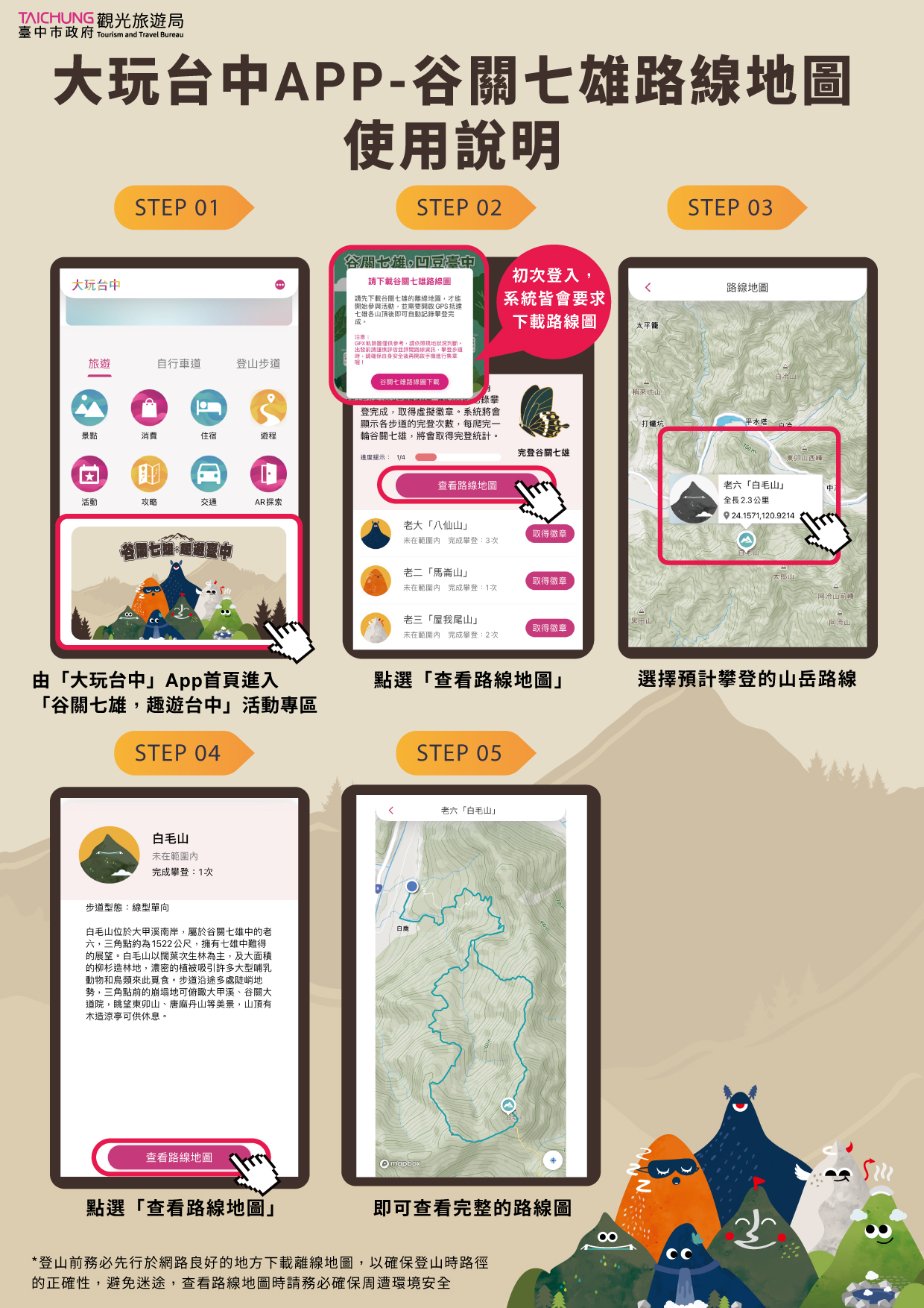
During the event period, participants can download the “Fun in Taichung app” and navigate to the “Hiking Promotion Zone” under the “Guguan Seven Heroes” mission page, to earn their badge through two available methods indicated below. Once you collect all seven virtual mountain badges, you can apply for both a digital Certificate of Completion and a physical commemorative badge through the “Achievement Badge” page in the app. (Physical badges are limited in quantity and available while supplies last.)
① GPS Check-in: At the summit of each mountain (near the triangulation point or elevation point), turn on GPS and tap the corresponding “Claim Badge” button for that mountain within the app. After your hike, ensure you are connected to the internet and tap “Sync Record” to upload your data to the server.
② Photo Review: If signal reception is poor on the mountain and you cannot check in via GPS, take a photo with the “triangulation point” or “elevation point”. Later, when you are in a stable internet environment, tap the “Photo Review” option under the “Claim Badge” button. Your submission will be reviewed by the designated person (within 1–3 working days), and once approved, you will receive the corresponding virtual badge.
【Photo Upload Guidelines】
✅Participants must enable the date stamp function on their phone or camera, or hold a handwritten sign showing the date and take a photo.
✅The photo must include the hiker posing next to the summit elevation marker post. (Not the triangulation point stone).
✅Photos should preferably feature the individual hiker. If submitting a group photo, please clearly mark the applicant for the complete certifier.
❌Invalid Photos: Submissions that do not meet these requirements will not be accepted for certification.
- Hiking Trail Missions
During the event period, participants can download the “Fun in Taichung App” and go to the Hiking Promotion Zone under the “Hiking Trail Mission” page to collect virtual trail badges through two available methods indicated below. Once you complete any trail, you can apply for a digital Certificate of Completion via the “Achievement Badge” page of the app.
GPS Check-in: At the “designated location” on each trail, turn on GPS and tap the “Claim Badge” button corresponding to the trail within the app. After your hike, ensure you are connected to the internet and tap Sync Record to upload your data to the server.
If signal reception is poor on the mountain and you cannot check in via GPS, you may take a photo at the “designated location” instead. Later, when in a stable internet environment, tap the “Photo Review” option under the “Claim Badge” button. Your photo will be reviewed by staff (typically within 1–3 working days), and upon approval, you will receive the corresponding virtual badge.
⭐ The first 200 participants to complete the Huanshan Hunters’ Hiking Trail will receive a limited-edition commemorative physical badge.ᐟ.ᐟ⭐
【Designated GPS Check-In & Photo Points for Hiking Trail Missions】
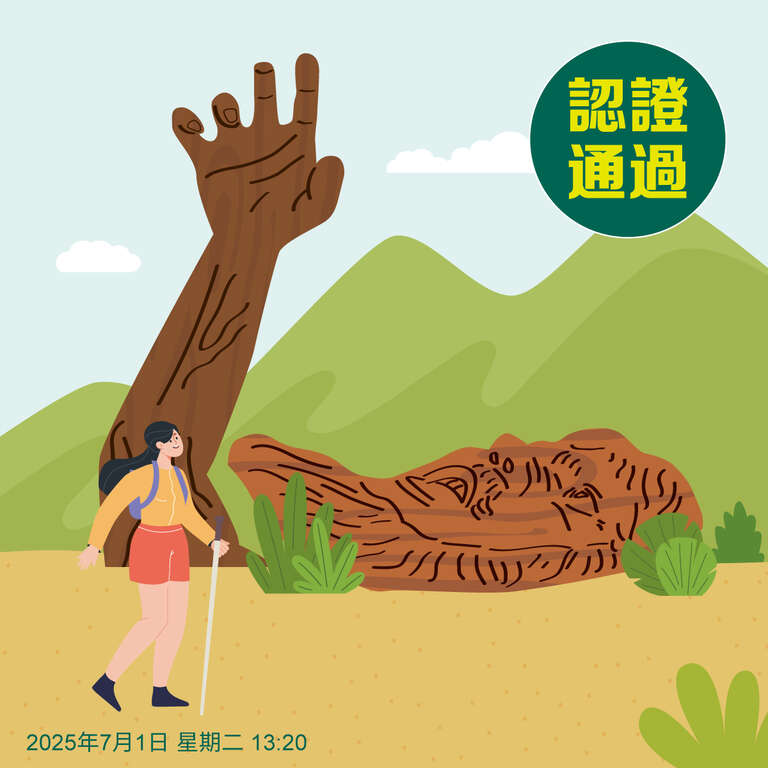
Xueshankeng Loop Trail: Hands of Colossus
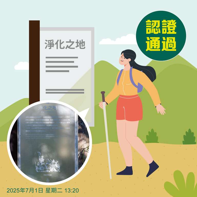
Huanshan Hunters’ Hiking Trail: Purification Site Interpretative Sign
【Photo Upload Guidelines】
✅Hikers must enable the date stamp function on their phone or camera, or hold a handwritten sign showing the date.
✅Hikers must take a photo at the designated location.
✅Photos should focus on individual hikers. For group photos, please clearly indicate the applicant for the certificate.


👉 Paper Certification Application 👈
- For young children, elders, or participants whose mobile devices do not support the Fun in Taichung App, certification may be completed using a paper achievement record form: [Download the “Guguan Seven Heroes” Record Sheet (PDF)] and [Download the Hiking Trail Mission Record Sheet (PDF)]
- Hikers must enable the date stamp function on their phone or camera, or hold a handwritten sign showing the date, and take a photo at the summit elevation marker post (for the Guguan Seven Heroes) or at the designated checkpoint (for Hiking Trail Missions). Photos should preferably feature the individual hiker. If submitting a group photo, please clearly indicate the applicant for the completion certification.
[ Designated GPS Check-In & Photo Points for Hiking Trail Missions ]
Xueshankeng Loop Trail: Hands of Colossus
Huanshan Hunters’ Hiking Trail: Purification Site Interpretative Sign
- Send the paper application form by mail to: Hiking Promotion Team, Rm. B, 2F., No. 302, Wenxin S. 3rd Rd., Nantun Dist., Taichung City 408, Tel: 04-3707-7218
- Applicants who use paper application form must remember to fill in English name and email address to facilitate the delivery of digital certificate.
III. Important Reminders:
- Friendly reminder: Please ensure your safety while climbing the trail before using your phone to collect badges.
- If the Fun in Taichung app does not show the Hiking Promotion Zone, please update the app. iPhone version download link and Android version download link
- The Guguan Seven Heroes certification is currently limited to a maximum of 10 ascents per participant. For hikers who have already completed all tenth ascent and wish to continue tracking their ascents, please use the GPS check-in method to earn badges. Do not use the Photo Review option beyond the tenth ascent.
- Any attempt to cheat or manipulate badge collection will result in account suspension and disqualification after review by the Certification Committee.
- Before your hike, please make sure to download and learn how to use offline maps to ensure accurate navigation and avoid getting lost. The Fun in Taichung app includes built-in maps for both the Guguan Seven Heroes and Hiking Trail Missions. When checking maps, always be aware of your surroundings and avoid walking while looking at your phone.
IV. Discover the Beauty of Taichung – Visitor Incentive Program
With its diverse natural and urban landscapes—mountains, coastlines, tun foothills, and vibrant city life—Taichung captivates travelers from around the world. To encourage visitors to stay overnight and experience the city in depth, the Taichung City Government Tourism and Travel Bureau offers incentives to licensed domestic travel agencies that design “2-day, 1-night itineraries focused on Heping District”. We warmly welcome travelers to experience the unique charm of Taichung!
※This program is open only to travel agencies officially approved by the Ministry of Transportation and Communications.
※A subsidy of NT$1,000 per person will be granted based on group headcount. Limited to 200 participants total; the program will close once the quota is reached.
Fun in Taichung Event Page:Click for Program Details
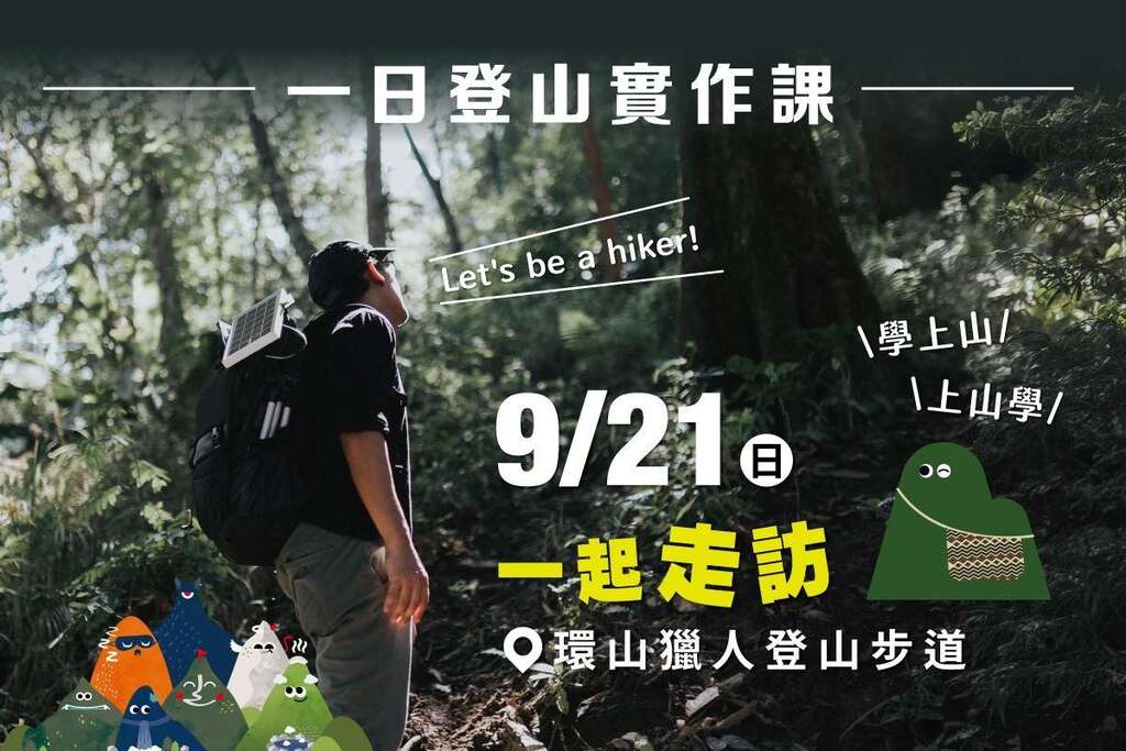
V. Mountaineering course
📣 Limited spots available, register online until fully booked
▍Mountaineering Safety lecture:https://reurl.cc/yAgNAy

▍One-Day Mountaineering Practice Course:https://reurl.cc/Nx6dYm
VI. Hiking Market
Information:https://reurl.cc/mYD3KG
")
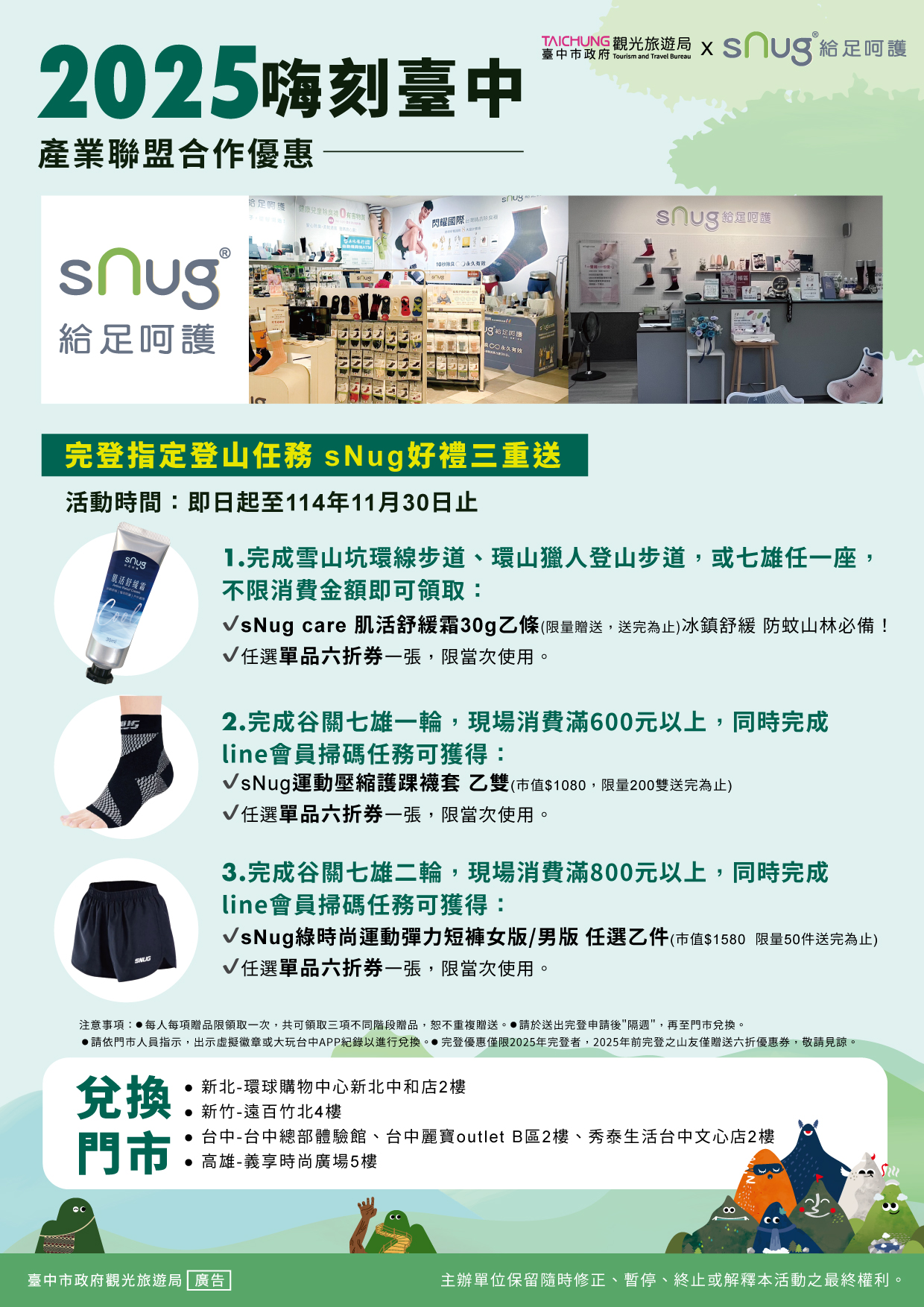
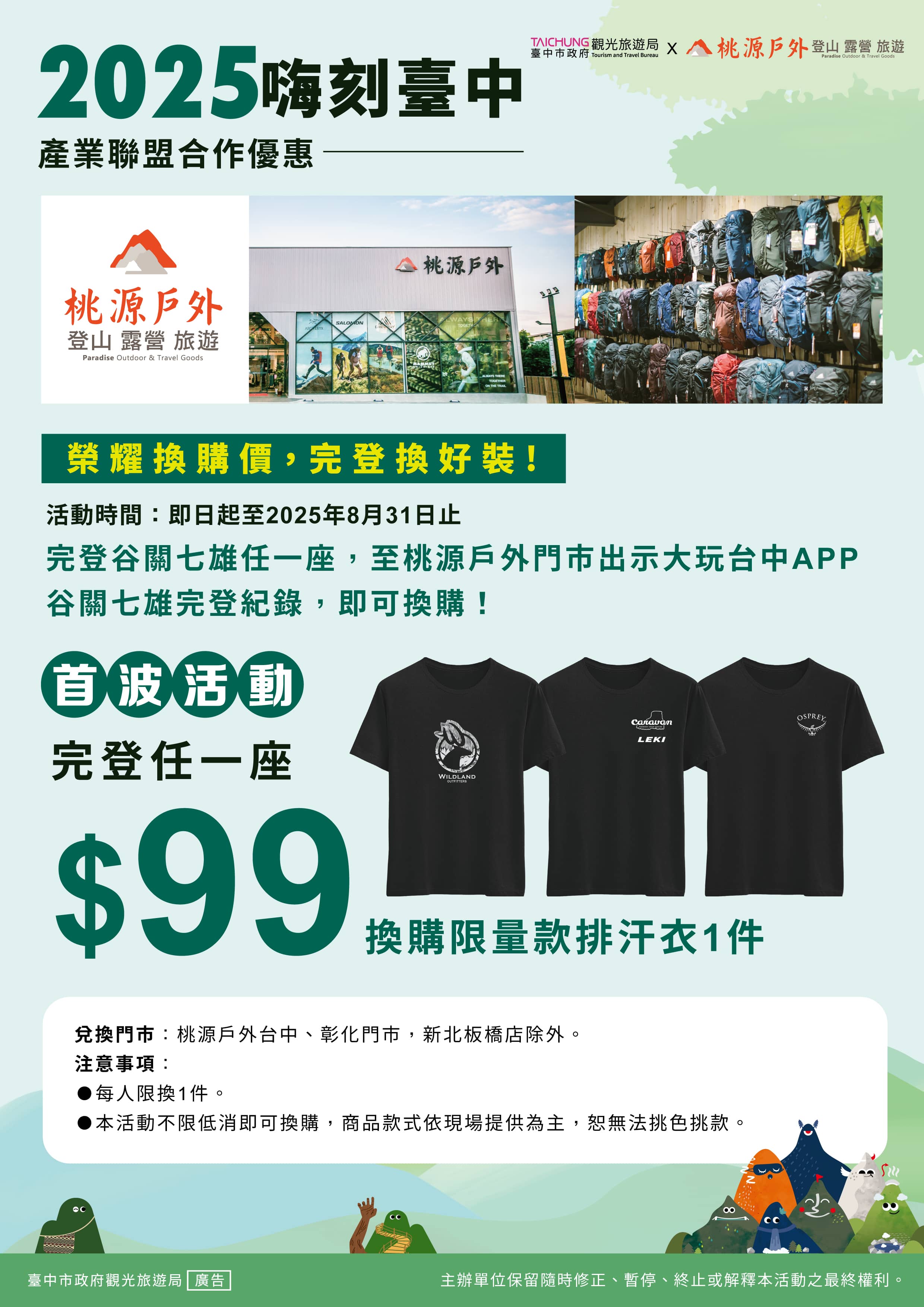
VII. Industry Alliance Offers:
sNug 給足呵護
Store information:https://www.facebook.com/supersocks.supersocks
📣The main branch in Taichung has moved! The new address is "B1, No. 760, Zhongming South Road, South District, Taichung City".
Guguan Hot spring discount
神木谷假期大飯店 Utopia Holiday Hotel
Store information:http://www.utopia-holiday.com.tw/
谷關溫泉飯店 KU KUAN HOT-SPRING HOTEL
Store information:https://www.kukuan.com.tw/index.aspx

桃源戶外 Polarstar
Store information:https://www.facebook.com/polarstar.tw
PokéPoké · 波奇波奇
Store information:https://www.facebook.com/pokepoketw/?locale=zh_TW

屋馬燒肉 Umai Yakiniku
Store information:https://www.facebook.com/umai.tw/?locale=zh_TW

VIII. Hiking Advisory Information
1. Pre-trip:
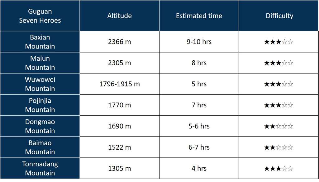
- "Guguan Seven Heroes" - The difficulty of climbing varies, with the shortest round trip taking about 4 hours and the longest requiring 9 to 10 hours. The terrain and landscape of the hiking trail are highly diverse. Before attempting the climb, individuals should assess their physical fitness and consider weather conditions, avoiding any forced climbs.
Prior to the climb, it is crucial to be well-prepared with adequate equipment. It is recommended to prioritize lightweight and practical gear. Suggestions include bringing warm clothing, rain gear, water, snacks, maps, lighting devices, whistles, positioning and communication equipment (e.g., GPS, radio, mobile phone, satellite phone), and personal medication.
Climbers are advised to start early to avoid reaching the summit late when visibility may be poor and the trail may be difficult to discern, leading to potential disorientation.
Under no circumstances should climbers enter the mountain during an approaching typhoon or in the event of heavy rain or any other foreseeable weather changes. - The “Huanshan Hunters’ Hiking Trail” is located in the Qalang Sqoyaw (Huanshan Tribe) of Heping District. As it is in a remote area, access requires passing through traffic control checkpoints at Wuling or Lishan. Hikers are strongly recommended to check road conditions in advance, allow ample travel time, and stay updated on seasonal traffic restrictions or weather changes to ensure a smooth and safe hiking experience.
2. During climbing:
The climbing group should not be too spread out and should maintain a responsive formation. Avoid climbing unmarked trails or creating new paths. Exercise caution when traversing dangerous and steep sections. Pay special attention while walking on crumbling walls and scree slopes to prevent falls. Plan the descent time carefully, especially as darkness falls quickly in the mountains.
3. Emergency Response Measures in the Event of a Mountain Accident:
In the event of an unexpected accident, it is important to remain calm and avoid panic. Immediately dial 119 or 112 on your mobile phone to request assistance, or use a satellite phone to seek help. You can also utilize the emergency rescue channel 145.00 on a two-way radio for distress signals. Provide the rescue team with your precise location coordinates by using your mobile phone or referencing your map.
If someone is injured or becomes ill, administer basic first aid such as simple bandaging, immobilization, and applying pressure to stop bleeding. In the case of altitude sickness, ly descend to a lower altitude and prioritize keeping the affected individual warm to prevent hypothermia.
In the event of becoming lost during the climbing activity or encountering sudden adverse weather conditions, seek a secure shelter to protect yourself. Establish appropriate markers or signs to help rescue teams locate your stranded position ly.
4. To mitigate the risks associated with mountain climbing, the Maritimen and Port Bureau, Ministry of Transportation and Communications (MOTC), encourages individuals engaging in mountain activities to equip themselves with satellite communication devices to facilitate search and rescue operations in case of emergencies:
To further reduce the risks of mountain climbing, the Maritime and Port Bureau, MOTC, has established the "Radio Beacon Management Information System," which supports the use of Personal Locator Beacons (PLBs). Individuals involved in mountain activities are encouraged to utilize this system to send distress signals, notifying search and rescue units to initiate rescue operations.For more details, please visit the Maritime and Port Bureau, MOTC's official website.
IX. Trail Introduction

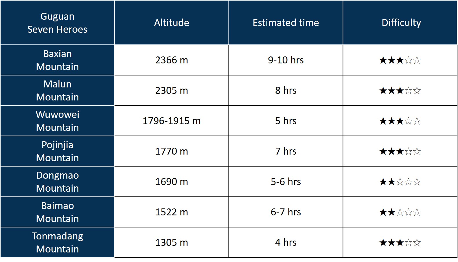
Baxian Mountain
• Elevation Difference: 1,337 meters
• Trail Type: Linear, Uni-directional
• Character Traits: Ranked first among the Guguan Seven Heroes, Baxian Mountain is symbolized by the coniferous forest atop its summit.

Malun Mountain
• Elevation Difference: 1,254 meters
• Trail Type: Linear, Uni-directional
• Character Traits: The Malun Mountain trail offers a wide and relaxing walk, providing a sense of ease.

Wuwowei Mountain
• Elevation Difference: 119 meters
• Trail Type: Linear, Bi-directional
• Character Traits: Do you prefer the thrilling and exciting Liyang Route? Or the comfortable and charming Great Snowy Mountains Route? It's an angel, but also a little devil!

Pojinjia Mountain
• Elevation Difference: 958 meters
• Trail Type: Linear, Uni-directional
• Character Traits: Pojinjia Mountain is a must-visit for those who want to experience the best of Guguan Hot Spring.

Dongmao Mountain
• Elevation Difference: 899 meters
• Trail Type: Linear, Uni-directional
• Character Traits: Zigzagging gently uphill, the longest and most beautiful footpath is on Dongmao Mountain.

Baimao Mountain
• Elevation Difference: 609 meters
• Trail Type: Linear, Uni-directional
• Character Traits: A stunningly expansive overlook, the popular Bailu Suspension Bridge is located on Baimao Mountain.

Tonmadang Mountain
• Elevation Difference: 655 meters
• Trail Type: Circular Loop
• Character Traits: The only trail with a waterfall view, where friendly butterfly fairies welcome you!
To the east, you can see Baxian Mountain and Malun Mountain, while to the west, there are Baimao Mountain and A-leng Mountain. Looking north, you can admire the distant views of Dongmao Mountain and Wuwowei Mountain. Along the way to the summit, there is a side trail that leads to the Butterfly Valley waterfall. Depending on your physical condition and available time, you can choose whether or not to visit this scenic spot. The Tonmadang Mountain trail is the only trail among the Guguan Seven Heroes that offers a waterfall view.

Xueshankeng Loop Trail
• Elevation Difference: 89 meters
• Estimated Hiking Time: Around 1 hour
• Location: Heping District
• Trail Type: Loop trail
• Trail Highlight: Nestled deep in the mountains, the “Hands of Colossus” adds a touch of mystery to the forest journey.

Huanshan Hunters’ Hiking Trail
• Elevation Difference: 227 meters
• Estimated Hiking Time: Around 2.5 hours
• Location: Heping District
• Trail Type: Loop trail
• Trail Highlights: This trail follows the traditional hunting paths of the Atayal people, offering hikers a meaningful cultural experience as they walk.
IX. Q&A
1. What are the Guguan Seven Heroes?
The Guguan Seven Heroes consist of Baxian Mountain, Malun Mountain, Wuwowei Mountain, Pojinjia Mountain, Dongmao Mountain, Baimao Mountain, and Tonmadang Mountain
2. Q: What are the two newly added hiking trail missions this year?
A: The “Xueshankeng Loop Trail” and the “Huanshan Hunters’ Hiking Trail”, both designed as leisure-level trails, encouraging hikers of all ages to enjoy the forest.
3. Q: How can I participate in the “Let’s Hike! Taichung!” campaign?
A: Follow these steps:
(1) Download the Fun in Taichung app and log in via the “Hiking Promotion” section.
(2) Go to the “Climb the Guguan Seven Heroes” or “Hiking Trail Mission” pages and tap “Claim Badge” using GPS or the Photo Review feature to collect your virtual badges.
(3) After collecting all seven mountain badges, go to the “Achievement Badges” section, tap “Certificate Application,” and complete the required form and questionnaire. Once submitted, the system will automatically issue your digital Certificate of Completion. By completing any one of the hiking trails, you may fill out the certificate application form and questionnaire, after which the system will automatically issue your digital Certificate of Completion.
(4) Complete any single mountain or any trail, or finish all Guguan Seven Heroes, and you can present your digital badge in the app to enjoy exclusive discounts from participating partner stores! For details, see Section 7: “Let’s Hike! Taichung!” Industry Alliance Offers, subject to each merchant’s official announcements.
4. Q: What is the duration of the event?
The certification program follows a inter year system, meaning there is no deadline—participants may begin the challenge at any time and continue accumulating completed climbs. However, please note that completion rewards may vary annually based on that year’s event planning.
5. Q: When can I receive the Certificate of Completion and commemorative badge?
Starting from 2024, only digital Certificates of Completion will be issued. After applying through the app, the system will proactively send the certificate to your registered email address. Be sure to provide an accurate and valid email to ensure successful delivery.
The commemorative badge will be mailed after your application is submitted, and processing may take up to one month.
6. If I have completed the Guguan Seven Heroes, but I don't have a smartphone, how can I participate in this event?
Please visit the Guguan Seven Heroes activity page on the Taichung Tourism website and download the Guguan Seven Heroes results record form provided at the bottom of the page (see attachment). Paste your photos onto this form as instructed. The photo requirements state that climbers should either GPS the date function on their mobile phone/camera or hold a handwritten time board while taking a photo with the stake at the summit elevation. After pasting the photo on the results sheet, please mail it to the following address: Rm. B, 2F., No.302, Wenxin S. 3rd Rd., Nantun Dist., Taichung City 408, Attention: Hiking Promotion Team(04-3707-7218). Once the staff have ed that the information is correct, your application for certificate will be considered complete.
7. If I want to climb specific mountains, can I apply partially online and partially on paper?
Please submit a single application. Online applications are recommended as a priority.
8. If I want to climb specific mountains, can I upload photos for some parts of my application and use GPS for other parts?
Yes, as long as you are within the range of the trig point setting, the badge will be automatically obtained through GPS application. If you are unable to obtain the badge automatically due to personal reasons, you can upload photos to apply for completing the Guguan Seven Heroes when you have internet access. All applications are done online through the app.
9. If I don't have internet access, can I still use GPS to complete the task?
Yes, GPS is a satellite positioning system, so you can collect virtual badges from the mountains even without internet access.
Note! Please make sure to download the Fun in Taichung APP and complete the member login before you go, as you will need internet access to do so.
10. What should I do if I have turned on my GPS but still cannot collect the virtual badge for the mountain?
Please follow the steps displayed on the system and upload a photo of yourself with the stake at the summit to the designated area of the app. Once the photo is approved, the virtual badge for that mountain will be sent to you, ing your completion of the climb.
Photo requirements: Climbers should ensure that the date function on their mobile phone/camera is activated or hold a handwritten time board while taking a photo with the stake at the summit. Individual photos are preferred, but if a group photo is submitted, please indicate the individual who has completed the climb for easier review by the system. (Please refer to point 1, item 2 of these instructions for more details.)
11. Can climbs recorded in 2023 be carried over to the next year for climbers to continue completing the activities of Guguan Seven Heroes?
Yes, as long as the same account is used to log into the Fun in Taichung App, the results will be automatically carried over across the years.
12. Q: I completed the Guguan Seven Heroes once before and applied for certification. If I complete it again in 2025, can I apply for a “first ascent” badge again?
A: No. Since the inter year system was adopted in 2022, if you completed first ascent by 2024 and continue in 2025, it will be automatically counted as your second ascent. First ascent badges will not be reissued.
13. Q: I didn’t apply for certification in 2021. Can I still apply this year?
A: No. Only participants who used the Fun in Taichung app in 2021 and logged an incomplete record are eligible for retroactive certification. If you did not use the app in 2021, any climbing photos from that year will not be accepted.
14. Q: Can I continue accumulating ascent if I’ve already completed more than 10 ascents “Guguan Seven Heroes” challenges?
The Guguan Seven Heroes certification is currently limited to a maximum of ten ascents per participant. For hikers who have already completed all tenth ascent and wish to continue tracking their ascents, please use the GPS check-in method to earn badges. Do not use the Photo Review option beyond the tenth ascent.
15. Q: Can I accumulate multiple ascent for the Hiking Trail Missions?
A: No. The new “Xueshankeng Loop Trail” and “Huanshan Hunters’ Hiking Trail” are one-time certification challenges. Completing each trail once is sufficient to earn a certificate—multiple ascents are not available. Currently, only the “Guguan Seven Heroes” offers multi-ascent challenges, including first, second, fifth, and tenth ascent certifications. You’re encouraged to continue taking on the challenge!